 |
| Edward arrived at Loders (Quirindi) from this direction... |
The main street of Quirindi lies along the railway and creek and most of it appears to date from about the turn of the 20th century. The great northern road from here up Moree is now called the Kamilaroi Hwy after the original custodians of this immense region. Apparently its the only major highway in Australia to be named for its original inhabitants.
 |
| ... and departed in this one. |
 |
| Not me. Lifestyle blocks in Quirindi today. |
After crossing this road Edward shortly again left it, and took the track to Warah. Warrah was an outstation of Goonoo Goonoo and was subdivided in 1912 into much smaller farms. The original homestead burnt down several times in the late 19th century but there are some fine photos from the late 1800s and other interesting information at www.warrah1912subdivision.com/127469402 if you're interested.
On the plains of Warrah, Edward cut some of the finely scented Myall wood that grows on these plains ... to carry a few specimens to England... whilst Smith baked a damper. Is that sandalwood I wondered? I asked Professor Google but it seems that it isn't. Its a type of acacia.
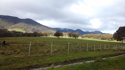
From these plains rose the bold chain of the Liverpool Range, the Cedar-brush Pass by which we were to cross, showing clear and distinct like a wide portal in the huge dark wall. I'm not sure why Edward chose this route. The current road goes through the Murrundi Pass about 20 kms to the east, as does the railway, which suggests that is an easier route. Murrundi Pass was known then but Edward's route does look marginally shorter so perhaps thats why he came this way.
 |
| Either he'd been sniffing too much of that finely scented Myall wood, or he was looking from a slightly different angle. His description of Cedar Brush Pass seems a bit over enthusiastic to me. |
I'd asked a number of people if the name Cedar Brush Pass meant anything to them and got blank looks but there is a Cedar Brush Nature Reserve, south of Warrah marked on maps, with a rough track marked across the ranges. We left our caravan in Quirindi and drove out through Warrah and then down the track. I stopped a man with a big hat and an even bigger Landcruiser ute coming off a farm on the track, because he looked like he'd know. I asked him if it was indeed the old Cedar Brush Pass. He confirmed that it was but that the road is pretty well impassable, especially when wet like now. He said that he'd heard rumors of a tree up on the Pass, carved with the initials of some of the first Europeans to cross it. He didn't know who, and despite looking for it on a number of occasions, had never been able to find it. We drove on a bit but finding our way blocked by running water, turned around and headed back to Quirindi where we enjoyed a lovely curry at an Indian restaurant, opened by 2 young Indian brothers just a week ago. Beats beef and damper.
 |
| Just for the record, that light shading on the hills just east of Cedar Brush Pass, is snow. |
No comments:
Post a Comment